


Now Reading: Extreme heat triggers warnings for N.J and NYC area today. Map shows where it will be hottest.
-
01
Extreme heat triggers warnings for N.J and NYC area today. Map shows where it will be hottest.
Extreme heat triggers warnings for N.J and NYC area today. Map shows where it will be hottest.
The extreme heat is prompting several weather advisories for the New York City area Friday.
Temperatures will skyrocket this afternoon, with highs in the 90s. That’s only half of the story, however, as dew points will be flirting with 70°. That said, the heat index will be 100-105 degrees, on average, with parts of New Jersey feeling like 105-110 degrees.
It’s a First Alert Weather Day as we deal with the high temperatures and humidity, along with a chance of strong to severe thunderstorms for the evening commute.
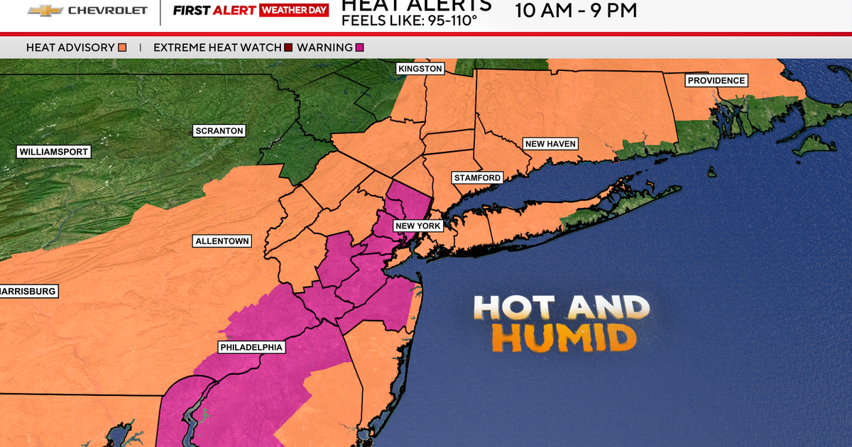
Extreme heat warning for northern and central N.J.
CBS News New York 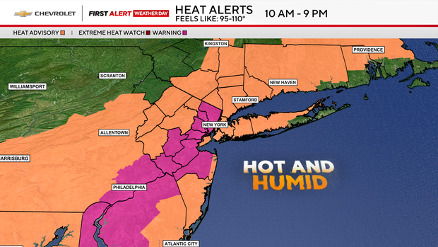
An extreme heat warning, formerly known as an excessive heat warning, has been issued for parts of New Jersey from 10 a.m. to 9 p.m. Friday. These areas will experience temperatures that feel like 105 to 110 degrees.
Excessive heat warnings are the highest form of heat alerts. They’re issued 24 hours in advance of heat indexes of at least 105 degrees or higher for at least two consecutive hours.
Heat advisory for Tri-State Area
CBS News New York 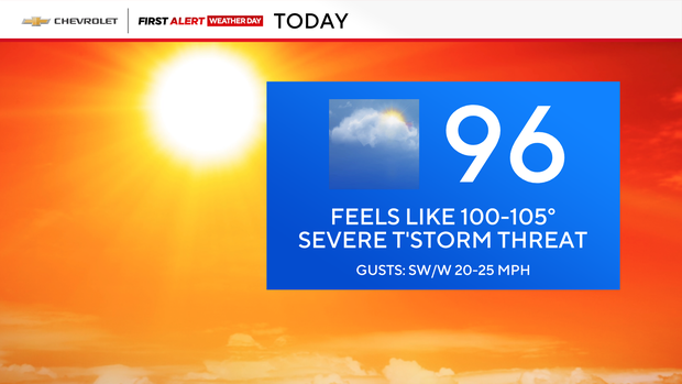
The rest of the Tri-State Area is under a heat advisory from 10 a.m. to 9 p.m., with feels-like temperatures between 95 and 105 degrees.
The weather is expected to cool off with highs in the 80s this weekend. It looks like Saturday is the better half, then thunderstorms will be back in the mix on Sunday.
N.Y. air quality alert
CBS News New York 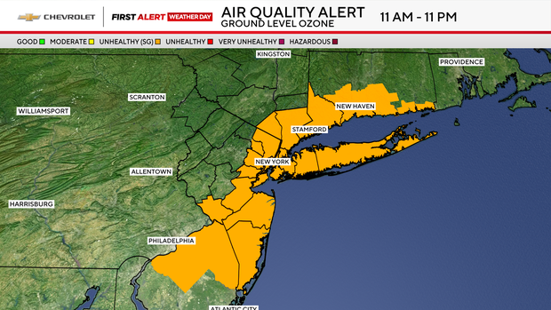
There’s also an air quality alert for much of the area from 11 a.m. to 11 p.m. Friday due to ground level ozone.
An air quality alert is issued when the Air Quality Index, or AQI, is higher than 100. Stagnant air can trap pollution and create high ozone levels, making respiratory issues worse.
An AQI in the 101-150 range is considered “unhealthy for sensitive groups,” including children, older adults, pregnant women and people with heart or lung disease.
Tracking thunderstorms
CBS News New York 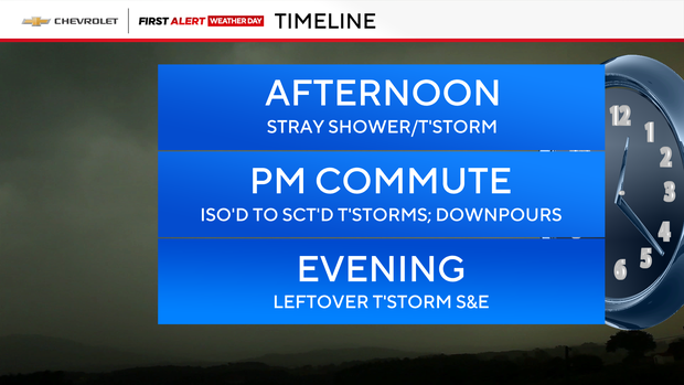
Meanwhile, we’re monitoring strong to severe thunderstorms pushing through just in time for the evening rush.
We should get through the first half of the afternoon nearly unscathed. Into the commute, however, hit and miss storms will move through our area, which will be capable of producing downpours and even locally damaging winds.
Thankfully, things will wind down after sunset, so the remainder of your evening should be fine.
Stick with our First Alert Weather Team for the latest forecast, live radar and weather alerts.


Related Posts

Stay Informed With the Latest & Most Important News


Advertisement


