


Now Reading: Seattle Weather | News, Weather, Sports, Breaking News
-
01
Seattle Weather | News, Weather, Sports, Breaking News
Seattle Weather | News, Weather, Sports, Breaking News

Good Tuesday evening!
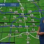
The heat peaks on hump day before temperatures tone down to goldilocks weather (not too hot, not too cold) in mid to upper 70s.
Overnight temps will be mild in the mid 50s. As you hit snooze on your alarm clock, expect morning stratus clouds overhead. Spotty drizzle/mist for coast and olympic peninsula. There’s a slight chance in the central/south sound. Take the PB&J and eat your lunch outside! By noon, clouds clear out and it’s dining al fresco weather in the upper 60 and low 70s. Afternoon highs tomorrow in the low to mid 80s in the central/sound sound. 70s for Everett and & north. 60s for the islands in the north sound and coastal communities.
Come Thursday, Mother Nature turns down the thermostat. We’ll stay in this pattern of morning clouds to afternoon sun. Highs will stay in the mid to upper 70s through the weekend. This is near seasonal standards. 79 is normal for this date. Looking ahead to the first weekend of August AKA Seafair weekend, we’re looking at mid to upper 70s (could change still far out).
Meteorologist Stella Sun
The KOMO 4Cast Team
Updated Tuesday Night


Related Posts

Stay Informed With the Latest & Most Important News
Previous Post
Next Post


Advertisement


