


New York City and the surrounding Tri-State Area could see some severe thunderstorms on Tuesday.
It’s a First Alert Weather Day as we track all the latest alerts. A flood watch has been issued for central New Jersey from 2 p.m. to 2 a.m. There will also be dangerous rip currents along New York’s south facing beaches.
Threat of thunderstorms around NYC today
CBS News New York 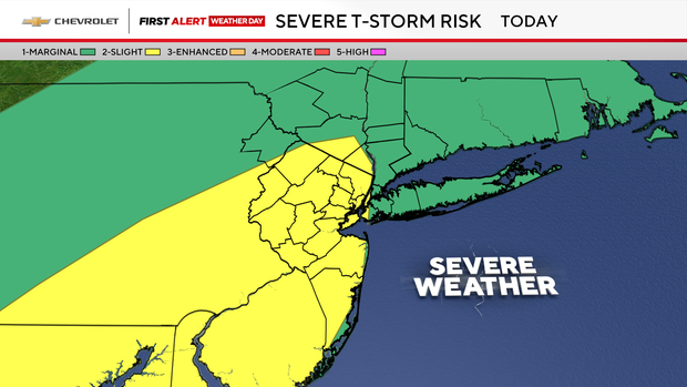
Much of the area dodged yesterday’s storms, but that won’t be the case today. The combination of today’s anticipated heat, tropical-like humidity and approaching cold front, will all serve for an action-packed afternoon.
Thunderstorms will begin to populate the area anytime after 1 or 2 p.m., with all bets off after about 3 or 4 p.m. Widespread thunderstorms are expected during the afternoon commute, with the potential for flash flooding and damaging winds.
CBS News New York 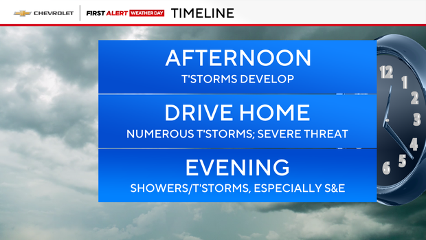
The shower and thunderstorm activity will be sustained into the first half of the evening with things winding down into the overnight hours.
4th of July forecast
CBS News New York 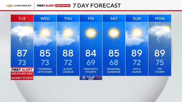
Tomorrow, we’ll transition from showers in the morning to sunshine by the afternoon.
Our next chance of thunderstorms will arrive on Thursday, some of which could be strong.
As for the Fourth of July, it looks like high pressure will get the upper hand this year.