


Now Reading: Tsunami evacuation orders lifted in Hawaii, threat to West Coast eases
-
01
Tsunami evacuation orders lifted in Hawaii, threat to West Coast eases
Tsunami evacuation orders lifted in Hawaii, threat to West Coast eases
Tsunami alerts blanketed the West Coast and Alaska after one of the strongest earthquakes in recorded history.
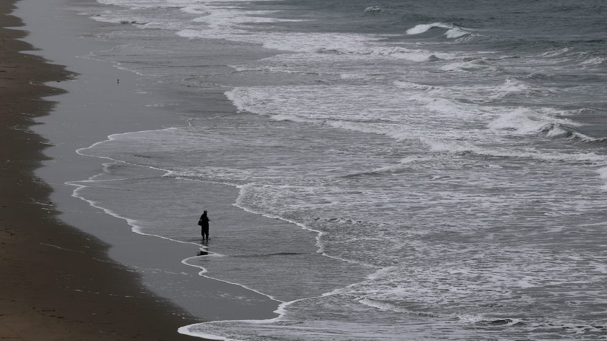
Tsunami waves reached Hawaii and the West Coast after a historically powerful earthquake struck off Russia’s coastline, but evacuation orders and an advisory in Hawaii were later lifted and beaches in Los Angeles County reopened on Wednesday as the threat to U.S. shores eased.
Russian officials reported little damage from the 8.8-magnitude temblor on Tuesday, the shaker creating tsunami waves that began arriving in Hawaii after 7 p.m. local time. Authorities braced for the possibility of major damage − tsunamis can cause a long series of waves, flood coastal areas and present other dangers for hours.
Less than four hours later, however, the risk to Hawaii was downgraded from a tsunami warning to an advisory, which was dropped in the morning. There were no reports of serious damage. Coastal areas of California, Oregon and Washington also canceled their advisories.
“I spoke to Governor of Hawaii @GovHawaii and the evacuation order has been lifted for coastal inundation zones,” Homeland Security Secretary Kristi Noem posted on social media July 30. “Please be careful when returning and watch out for damage. We will continue to monitor in Hawaii, Alaska, and California.”
State emergency management officials in Hawaii said widespread flooding was not expected. But they urged residents to “remain cautious in or near the water. … Stay away from beaches, shorelines, and out of the ocean.”

How are tsunamis formed?
Giant waves can cause massive destruction wherever they strikes. But what sets apart regular waves from a powerful tsunami? Here’s what to know.
Developments:
∎ Chile and Colombia issued evacuation orders for their Pacific coastline, and Chile also extended the precautions to its Eastern Island, about 2,300 miles off the mainland. Likewise, Ecuador ordered evacuations for parts of its Galapagos Islands.
∎ Automated alerts for the Axial Seamount, the underwater volcano off the Oregon coast, were triggered by the giant earthquake and subsequent tsunami. It was a false alarm. The volcano did not erupt, and it hasn’t since April 2015.
∎ The Marquesas Islands, part of French Polynesia in the South Pacific, were hit by smaller waves than previously feared. Officials canceled a tsunami alert.
In California, Los Angeles beaches reopened and a tsunami advisory was canceled for San Diego and Orange counties. Later in the day, an advisory for most of the state’s coastline was lifted as well. However, the portion from the Oregon border south to the county line between Humboldt and Del Norte remained under an advisory.
The National Weather Service office in Los Angeles said strong currents will continue along the state’s coast, including those parts not under a tsunami advisory, at least through Wednesday. Although widespread inundation isn’t expected, localized damage at harbors is possible because of the water surging in and out.
Port San Luis in the central coast, including Avila Beach, will be of “particular concern.”
Tsunami waves began arriving overnight at Crescent City and Humboldt Bay on California’s northern coast. Crescent City is located along a stretch of the West Coast considered most vulnerable to tsunamis based on previous events, according to the National Oceanic and Atmospheric Administration. The waves get amplified in the area and are higher in the city’s harbor than at other locations along the coast.
“A Tsunami Advisory is in effect for coastal Del Norte, Humboldt, and Mendocino Counties,” the weather service in Eureka posted on X July 30. “Tsunami waves of 1-3 ft are still … observed early this morning. Avoid beaches and harbors.”
Water levels continue to surge back and forth within minutes at tide gauges in Hawaii and along the U.S. West Coast.
One of the biggest surges was seen at Kahului Harbor on the northern coast of Maui, as the tsunami began to arrive. The NOAA tide gauge station shows the water receded to a level of minus 2.35 feet, then surged to 6.75 in just 18 minutes, a difference of more than 9 feet.
Some nine hours later, the tide was still rising and falling as much as 3 feet within about 12 minutes, according to the preliminary measurements from the tide gauge.
At Port San Luis in central California, the tide level changed more than 2 1/2 feet in just 12 minutes, according to preliminary measurements from NOAA.
The notion of a tsunami may inspire thoughts of long rides for some intrepid surfers, but its waves are nowhere close to surfable and quite different from the ones at Malibu beach or Oahu’s North Shore.
During tsunamis, the entire water column from the surface to the bottom of the ocean gets moved, generating an enormous amount of energy and rushing into land like a flood, often carrying debris.
Tsunami waves are much faster − around 500 mph at the deepest points. That’s the speed of a commercial plane at cruising altitude, though they slow down considerably near the shore. They also don’t break into a curl like surfing waves.
The time in between waves in a tsunami is measured in minutes and even hours, not seconds as with wind waves. Oh, and watch out when a tsunami wave recedes, leaving the seafloor exposed for a long stretch.
Noem, in Chile for meetings, said the tsunami was expected to have “minimal impact” in the U.S.
“We were fully deployed and ready to respond if necessary, but grateful that that we didn’t have to deal with the situation that this could have been,” Noem said.
She said FEMA was at an “enhanced level” an that the Coast Guard was deployed. Noem, asked if FEMA is equipped to handle no-notice disasters, responded with a familiar refrain.
“We should always remember that FEMA was established to be an agency that supports local authorities,” she said. “Our job with FEMA is to come in and support their efforts, and we will continue to do that. But these governors have done a fantastic job being prepared for the situation they faced yesterday, and then going into today.”
Tsunami waves began arriving along the coast of Washington state, where a tsunami advisory was in effect, shortly after midnight local time. The weather service said, “strong and unusual” currents were likely, but coastal inundation was not expected.
“We continue to see tsunami waves arrive along the coast as well as Strait of Juan de Fuca,” the weather service office in Seattle posted seven hours later. “Reminder: Do not attempt to go to the shore to observe the tsunami waves. Keep away until local officials say it is safe to return.”
A tsunami watch was downgraded to an advisory in Oregon. The weather service in Portland warned that “while tempting, do not go to the coast to watch waves coming in. Currents can be unpredictable and it will be dark out.”
Initial tsunami warnings have been cancelled or downgraded in much of Alaska, but an advisory still exists along the state’s Aleutian Islands and the Alaska Peninsula along an over 1,000-mile stretch from Attu Island to Chignik Bay, according to the National Weather Service in Anchorage as of 2:45 a.m. local time.
Currents at beaches and harbors, marinas, bays and inlets can be especially dangerous in the wake of tsunami waves and the danger can last for days, forecasters said.
Tsunami waves have been recorded at gauges along the Aleutian Islands, with the highest wave of 2.7 feet near Adak Island at about 10:21 p.m. local time on July 29.
“Impacts from Tsunamis may continue for many hours to days after arrival of the first wave,” forecasters said.
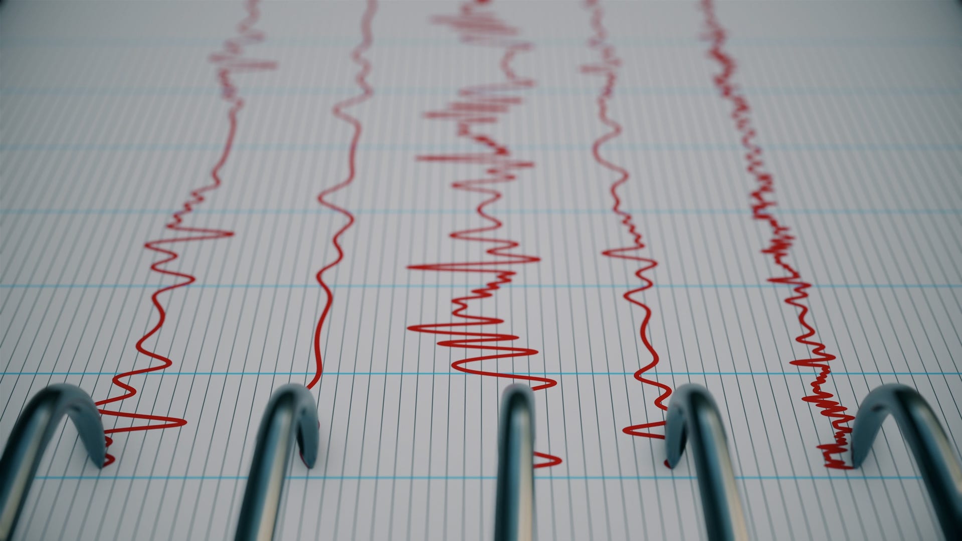
The magnitude 8.8 earthquake that struck off Russia’s Kamchatka Peninsula is now among the ten largest ever recorded on the planet. With a depth of about 12 miles, the shallow quake was recorded at 7:24 p.m. ET approximately 78 miles east-southeast of Petropavlovsk-Kamchatsky, Russia, according to the U.S. Geological Survey (USGS). Kamchatka and Russia’s Far East sit on the Pacific Ring of Fire, the geologically active region known for intense earthquakes and volcanic eruptions.
In a video posted to the Telegram messaging app, Kamchatka Gov. Vladimir Solodov said preliminary information indicates there were no injuries but added that a kindergarten building was damaged.
Solodov described the quake as “serious and the strongest in decades.”
The Klyuchevskoy volcano on the Kamchatka peninsula in Russia’s far east started erupting after a powerful earthquake in the Pacific, Russian state news agency RIA reported. According to preliminary information, hot lava is flowing down the western slope, explosions were heard and a bright glow was visible above the volcano, RIA said.
Last week, rescuers recommended tourists not visit the volcano due to the increased activity. Klyuchevskoy volcano, 16,000 feet above sea level, last erupted in April 2025.
− Dan Morrison
The United States is served by two tsunami centers operated by the National Oceanic and Atmospheric Administration. The Pacific Tsunami Warning Center serves the Hawaiian Islands, the Pacific and Caribbean territories and the British Virgin Islands. It also covers the international forecast for nations in the Pacific and Caribbean Basins. It’s located on Hawaii’s Ford Island, on the south side of Oahu near Pearl Harbor.
The other, the National Tsunami Warning Center, serves the mainland United States, Alaska and Canada. The warning centers are staffed 24/7 to monitor for tsunamis or earthquakes that could cause them, issue tsunami messages and work to improve warnings.
The Pacific Tsunami Warning Center was first established in the wake of official tsunami warnings that began in 1949, in response to a 1946 tsunami that devastated Hilo, Hawaii, known as the April Fools Day Tsunami.
Shortly before 11:30 p.m. ET, a tsunami advisory was upgraded to a warning for the coastal areas of California, from Cape Mendocino to the Oregon-California border, the weather service said. A tsunami warning means significant inundation is possible.
Earlier in the night, President Donald Trump took to social media to warn of the tsunami.
“Due to a massive earthquake that occurred in the Pacific Ocean, a Tsunami Warning is in effect for those living in Hawaii,” he posted on X. “… STAY STRONG AND STAY SAFE!”
Most areas along the U.S. Pacific Coast can expect a tsunami of less than 1 foot, the National Weather Service said just after 10:30 p.m. E.T. But even a tsunami of that size can generate deadly currents, the weather service warned.
Are earthquakes happening more? What to know on earthquake frequency.
Are earthquakes happening more often with greater severity? Here is what we know now.
After authorities urged residents and tourists to move to higher ground and evacuate from coastal zones, initial data showed waves arriving on the evening of July 29 were less than the potential projected maximum of 9.8 feet.
Tsunami waves in Hawaii reached amplitudes of up to 5.7 feet in Kahului, Maui, a measurement that compares the wave to height above normal sea level, the weather service said. In Hilo, the wave amplitude reached 4.9 feet.
“Look, everything has been OK so far. We haven’t seen a big wave,” Green said at around 8:30 p.m. But he said officials were concerned about an earlier pullback of water, which can signal a tsunami risk.
The state of Hawaii is one of the more tsunami susceptible spots in the world, thanks to its remote location in the Pacific Ocean, surrounded by the infamous seismic activity known as the “ring of fire.”
Tsunami waves can arrive in the islands from any location around the ocean, including Russia, South America and Alaska and the Aleutian Islands, according to the National Oceanic and Atmospheric Administration. On average, Hawaii experiences destructive tsunamis about once every 11 years.
The earliest historical accounts emerge from oral histories of the islands, including a 16th century chant about a wave that struck the coast of Molokai’i.
A tsunami warning was issued for Hawaii, according to the state’s Department of Emergency Management. The agency estimated that the first tsunami wave will arrive at around 7:17 p.m., Hawaii Standard Time.
“A tsunami has been generated that could cause damage along coastlines of all islands in the state of Hawaii,” the agency said in a bulletin. “Urgent action should be taken to protect lives and property.”
The Honolulu Department of Emergency Management called for the evacuation of some coastal areas in Hawaii. “Take Action! Destructive tsunami waves expected,” the Honolulu Department of Emergency Management said on X.
In a video update at 5:50 p.m. local time, Green said authorities were prepared and noted that county officials were “fully involved” in emergency management. The governor warned residents and visitors to not be outside on all shorelines when the wave strikes, adding that warning sirens will be used within the next hour.
“(The earthquake has) caused a wave we believe that will be significant,” Green said. “People need to evacuate — that’s very clear. They have to be out of the evacuation zone or up four stories.”
Shortly after the initial tsunami warning sirens went off at around 3 p.m. local time in Hawaii, the streets of Honolulu, including the tourist hub Waikiki, were congested as people quickly tried to move to higher ground and away from coastal evacuation zones. Some reported long lines at gas stations, as sirens continued to go off on the hour to the estimated first wave.
Oahu local Megan Lee said she hit more traffic than usual on her commute home from work. “It’s nice to see everyone taking it seriously,” Lee told USA TODAY. “It’s always scary to get an alert like that.”
Some felt desensitized to the warning following the 2018 false missile alert, when residents woke up to an emergency alert notification that a ballistic missle was headed their way. Residents across the islands scrambled to find shelter before learning it was sent as an error.
Lee, who was living on Oahu during the false missile alert, said she feels desensitized to these types of warnings. “It makes me not take the sirens as seriously, unfortunately,” she said. “We get a lot of alarms in Hawaii, and you see people going surfing because there’s a tsunami warning.”
Those living more inland said they’re not as concerned about the warning, like Honolulu resident Julie Shimer. “I think it’s great (the state) is being more cautious,” Shimer told USA TODAY. “It’s always better being more prepared just in case.”
In a statement sent on the afternoon of July 29, Honolulu Mayor Rick Blangiardi said, “Residents and visitors are urged to monitor local media for updates and stay away from the coastline. For those flying in or out of Hawaii today please check with your airline for the status of your flight.”
— Kathleen Wong
In San Diego County, officials were monitoring the situation on the evening of July 29. San Diego County spokesperson Chuck Westerheide said the county would issue an alert if necessary, but stressed that so far, a tsunami advisory was all that was in place.
“As of 8:08 p.m. (local time) we are in an advisory area, meaning strong currents and a tsunami are possible and waves and currents can kill or injure people who are in the water,” Westerheide said. “But that’s key — people who are in the water.”
“Currents at beaches in harbors, marinas, bays and inlets may be especially dangerous,” he added.
Ilya Zaides, who lives on the beach in La Jolla, said he was monitoring X while also waiting to see if an official alert would be issued.
“We’re going to wait and see if there’s an alert, and hopefully there will be enough time to leave if we need to,” Zaides said.
— Will Carless
The tsunami warning for Alaska includes coastal areas from Attu to Samalga Pass. The tsunami advisory has been expanded to areas from Samalga Pass to Chignik Bay. Expected tsunami start times in Alaska include the following: 6:45 p.m., Unalaska; 7:25 p.m., Sand Point and 8:00 p.m. Cold Bay.
The National Tsunami Warning Center advises that tsunami activity is possible at Shemya, Alaska beginning at 4:46 p.m., Alaskan Daylight Time, then at 5:46 p.m. at Adak and 7:06 p.m. at Saint Paul, about 760 miles west of Anchorage.
A buoy south-southwest of Attu, Alaska detected a tsunami wave of 3 feet, the weather service reported. The measurements from DART buoys are from the deep ocean and are generally much smaller than the wave would be when it arrives at the coast, the weather service said.
In San Francisco and Monterey, California, the weather service expects to see tsunami heights of less than one feet, but advises it could present strong and hazardous currents.
“Move off the beach and out of harbors and marinas,” the weather service said. “Do not go to the coast to watch the tsunami.”
In San Diego, the weather service said the area should not expect widespread inundation, but advised people in coastal areas under the advisory to stay off the beach and out of harbors and marinas.
“Dangerous and powerful currents are still expected within the ocean and along the coast,” said Dial Hoang, a weather service meteorologist in San Francisco. “In 2011, a man near Crescent City died after he was swept out to sea while trying to photograph the tsunami coming in.”
The highest peak wave is forecast for Crescent City, California, where the height could peak at between 2.9 feet and 5.4 feet, with tsunami waves lasting for 36 hours. In Port San Luis, California, the waves could peak at 2 to 3.8 feet and last for 24 hours, the weather service warned.
Possible tsunami start times stretch from 8:20 p.m. local time in Kodiak, Alaska, southward along the coast to La Jolla, California, where tsunami activity would be expected to begin by 1:15 a.m. local time.
Estimated tsunami start times, in local times, for selected sites are:
- Alaska: Kodiak – 8:20 p.m., Seward – 8:45 p.m., Sitka – 8:55 p.m., Homer – 9:40 p.m., and Craig – 9:55 p.m.
- British Columbia: Langara – 10:05 p.m. and Tofino – 11:30 p.m.
- Washington state: La Push – 11:35 p.m., Port Angeles – 12:20 a.m. on July 30, Port Townsend – 12:45 a.m. on July 30, and Bellingham – 1:10 a.m. on July 30
- Oregon: Port Oxford – 11:40 p.m., Charleston – 11:45 p.m., Brookings – 11:50 p.m., Seaside – 11:55 p.m., and Newport – 11:55 p.m.
- California: Fort Bragg – 11:50 p.m., Monterey – 12:15 a.m. on July 30, San Francisco – 12:40 a.m. on July 30, Los Angeles Harbor – 1:05 a.m. on July 30, and La Jolla – 1:15 a.m. on July 30
Along the West Coast, the weather service warned after 10 p.m. ET that widespread inundation is not expected in most locations. The weather service office in Seattle, Washington has advised that the tsunami waves are expected to arrive on the coast at Moclips at 11:50 p.m. and last for nine hours. The forecast peak of the highest wave is .8 to 1.4 feet, the weather service said.
“This is a significant, real event,” said Reid Wolcott, a meteorologist with the weather service in Seattle. “The imminent threat is for Alaska and areas near the quake. The National Tsunami Warning Center needs additional observation information before more is known about the threat to the US West Coast.”
It will take time for ocean buoys and other observations to come in so that the tsunami warning centers can make a forecast with real data, Wolcott said.
Though the peak of the tsunami could be less than a foot, the weather service has warned that it could still be dangerous. Estimated wave heights for selected sites are:
- Alaska: Adak – 1.2 to 2.2 feet; and Unalaska, Saint Paul, Sand Point, and Cold Bay are all less than 1 foot.
- British Columbia: Langara and Tofino are less than 1 foot
- Oregon: Port Orford – 1 to 1.8 feet, Charleston – less than 1 foot, and Brookings – 0.8 to 1.5 feet
- Washington state: Moclips – 0.7 to 1.3 feet; and Neah Bay, Long Beach, Westport, Port Angeles, Port Townsend, and Bellingham are all less than 1 foot.
- California: Fort Bragg – 0.8 to 1.4 feet; Crescent City – 2.9 to 5.4 feet; Santa Barbara, 0.7- 1.3 feet; and Monterey, San Francisco, Los Angeles Harbor, Newport Beach, and La Jolla are all less than 1 foot.
AccuWeather meteorologists said they are monitoring the “developing tsunami threat that may impact coastal areas of Hawaii, Alaska, and the western United States.”
“Any earthquake with a magnitude greater than 7.0 poses a tsunami risk, even thousands of miles away from the epicenter,” said AccuWeather Vice President of Forecast Operations Dan DePodwin. “The force of water from tsunamis is incredibly violent and destructive.”
Preliminary data currently indicates that strong currents, wave surges, and possible inundation in low-lying areas are possible in areas where tsunami warnings have been issued, according to AccuWeather.
“This earthquake is likely to be in the top 10 strongest ever recorded. The strongest was the 1960 Valdivia earthquake in Chile, which was 9.4-9.6 magnitude. The March 2011 earthquake that triggered the tsunami which devastated parts of Japan was a 9.0-9.1 magnitude,” DePodwin added. “Although not all major earthquakes lead to tsunamis, the risk must be taken seriously until the threat has passed.”
DePodwin noted that a tsunami would not reach Hawaii for at least several hours and advised the public to follow guidelines from local emergency officials.
The Japan Weather Agency upgraded its warning, saying it expected tsunami waves of up to 10 feet to reach large coastal areas starting around 10:00 a.m. local time. Much of Japan’s eastern seaboard, which was devastated by a powerful earthquake and tsunami in 2011, was ordered to evacuate.
Tsunami alarms sounded in coastal towns across Japan’s Pacific coast with authorities urging people to seek higher ground.
The U.S. Tsunami Warning System also issued a warning of “hazardous tsunami waves” within the next three hours along some coasts of Russia, Japan and Hawaii. A tsunami watch was also in effect for the U.S. island territory of Guam and other islands of Micronesia.
In Guam, the weather service is warning of sea level fluctuations and strong ocean currents that could be a hazard along beaches and in harbors. The weather service has advised people to get out of the ocean and move away from beaches and harbors, following the instructions of local government officials. The estimated time of the activity in Guam, Rota, Tinian and Saipan is 2:37 p.m. local time.
A tsunami advisory is in effect for American Samoa, where hazardous sea level fluctuations and strong ocean currents could occur beginning at 9:39 p.m. local time. Tsunami alerts also are in effect along the coast of Central and South America.
The powerful earthquake generated a tsunami of up to 13 feet in Russia, prompting evacuations and damaging buildings, officials said.
“Today’s earthquake was serious and the strongest in decades of tremors,” Kamchatka Gov. Vladimir Solodov said in a video posted on the Telegram messaging app, according to Reuters.
Multiple aftershocks were also recorded following the major quake, ranging between a magnitude of 5.2 and 6.9, according to the USGS. Kamchatka and Russia’s Far East sit on the Pacific Ring of Fire, a geologically active region that is prone to major earthquakes and volcanic eruptions.
Russia’s Ministry for Emergency Services said on Telegram that the port in the Sakhalin town of Severo-Kurilsk and a fish processing plant there were partially flooded by a tsunami. The area was evacuated.
While a kindergarten was also damaged, no serious injuries or fatalities had been reported, the ministry added.
The National Weather Service said tsunami messages are issued by the tsunami warning centers to alert local authorities and the public of a possible tsunami. There are four levels of tsunami alerts, according to the weather service:
- Tsunami Warning: “Take Action—Danger! A tsunami that may cause widespread flooding is expected or occurring. Dangerous coastal flooding and powerful currents are possible and may continue for several hours or days after initial arrival.”
- Tsunami Advisory: “Take Action—A tsunami with potential for strong currents or waves dangerous to those in or very near the water is expected or occurring. There may be flooding of beach and harbor areas.”
- Tsunami Watch: “Be Prepared—A distant earthquake has occurred. A tsunami is possible.”
- Tsunami Information Statement: “Relax—An earthquake has occurred, but there is no threat or it was very far away and the threat has not been determined. In most cases, there is no threat of a destructive tsunami.”
A real-time tsunami monitoring system created by the Pacific Marine Environmental Laboratory in Washington placed buoys at strategic locations throughout the ocean and they play a critical role in tsunami forecasting, according to the NOAA. The buoys are named DART, for Deep-ocean Assessment and Reporting of Tsunamis.
When a tsunami event occurs, the first information available is the seismic information from the preceding earthquake, according to NOAA. As the tsunami wave moves across the ocean, it reaches the DART systems, which report sea level information measurements to the Tsunami Warning Centers. That buoy data is used to refine estimates of the tsunami source and to make the forecasts for watches, warnings and evacuations.
The Pacific Marine Environmental Laboratory is working on a third generation of the buoy system, but the laboratory is one of those proposed to be closed under the budget NOAA has proposed for the coming year.
Contributing: Reuters


Related Posts


Stay Informed With the Latest & Most Important News
Previous Post
Next Post


Advertisement


