


Now Reading: What is the ‘ring of fire’? This week’s earthquake just the latest in this region
-
01
What is the ‘ring of fire’? This week’s earthquake just the latest in this region
What is the ‘ring of fire’? This week’s earthquake just the latest in this region
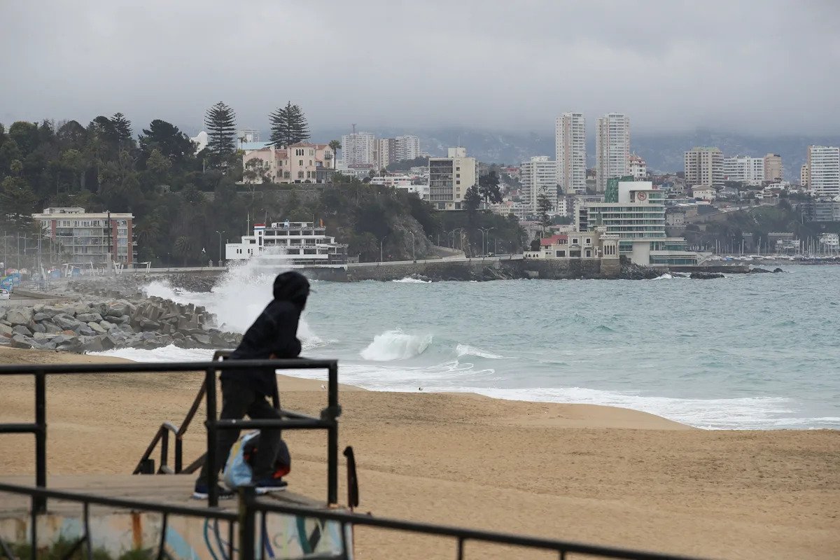
The magnitude 8.8 earthquake that struck off Russia’s Kamchatka Peninsula on July 29 may have been one of the 10 largest ever recorded on the planet, but it wasn’t totally unprecedented.
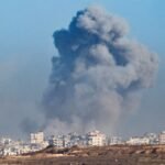
The earthquake spawned waves that reached Hawaii and the West Coast in the U.S., launching emergency warnings and evacuations on Tuesday, July 29. Waves up to 13 feet generated by the quake prompted evacuations and damaged buildings in Russia, while Japan was also placed under a tsunami warning. The peninsula’s Klyuchevskoy volcano also began erupting on Wednesday, July 30, reported Reuters.
Kamchatka and the waters off its coast are no strangers to quakes, however. The peninsula is located within the so-called “ring of fire,” a region known for its seismic and volcanic activity. Here’s what to know about the area.
What is the ‘ring of fire’?
The “ring of fire” is a horseshoe-shaped region in the Pacific about 25,000 miles long that contains more than 450 volcanoes, according to the National Oceanic and Atmospheric Administration (NOAA).
The “ring,” as NOAA says, extends “from the southern tip of South America, along the west coast of North America, across the Bering Strait, down through Japan and into New Zealand.” Its volcanoes also extend further south into Antarctica.
Preview link: code:
The “ring of fire” is the result of plate tectonics – giant moving slabs of rock millions of square miles across that can collide with or pull away from one another. Heavier plates can slide beneath lighter ones, heating and melting the rock and creating magma.
“Three out of every four live volcanoes on Earth are here,” according to National Geographic. “Almost all earthquakes happen here, too.”
One such eruption occurred after the July 29 earthquake, when Klyuchevskoy, one of the tallest volcanoes in the world, located 280 miles north of the Russian city of Petropavlovsk-Kamchatsky, began erupting with burning hot lava, reported Reuters.
What does the ‘ring of fire’ have to do with the Russian earthquake?
Kamchatka is situated within the “ring of fire,” making earthquakes and resulting tsunamis and volcanic eruptions far more common and likely than in other, less tectonically active areas of the world.
The southern part of the Kamchatka Peninsula lies above two colliding plates: the Pacific plate and the Okhotsk microplate, according to the United States Geological Survey (USGS) and Britannica. This area, which falls along the Kuril–Kamchatka Trench or Kuril Trench, is known as a convergent boundary. The northern part of the peninsula lies across the boundary between two blocks in the North American plate, the Kolyma-Chukotka and Bering Sea microplates.
Major seismic activity has been recorded in the area since 1737, when a magnitude 9.3 earthquake was estimated to have occurred. A magnitude 9.0 quake off the coast triggered a large tsunami in 1841, as did a magnitude 8.4 event in 1923 that triggered a 7.6-meter tsunami and killed three in Russia and one in Hawaii.
In 1959, a magnitude 8.3 quake occurred, followed by one measured at magnitude 7.6 in 2006 and a magnitude 7.5 in 2020.
This article originally appeared on USA TODAY: What is the ‘ring of fire’? Pacific is no stranger to earthquakes


Related Posts


Stay Informed With the Latest & Most Important News
Previous Post
Next Post


Advertisement


